
Processing mine as we speak. I hope to try it later tonight if it is finished.
Andrew
Processing mine as we speak. I hope to try it later tonight if it is finished.
Andrew
I purchased P3d and a bunch of add ons. I now have the buyers remorse. I never use it, just too slugish in VR, and does not look nearly as good as Aerofly. For me, it is Aerofly all the way from here on.
Andrew
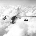
B-47 Stratojet Bomber
Oh... B-47, that is almost a forgotten bomber. That would be great. How about a B-36 with the 6 pushers, and 4 jets?
About 30 years ago I used to fly hang gliders, a few times at Harris Hill, but mostly at Hammondsport and Dansville with the Finger Lakes Association of Pilots (FLAP)
Back when I was young and invincible.
I generated some scenery for Dansville and you can still the the launch clearing I helped to brush out on the ridge.
It sure brought back some memories.
Totally enjoying the ASG29
Very cool! I know both of those areas. Last I heard Dansville airport was not operating too much. Not sure about the hang gliding though. I don't mind being seated in a glider, but hanging from a wing takes larger nuggets than I have. LOL
Andrew
You need to make sure that you are converting your projects with enough of levels for starters. When levels are missing it leaves a void in the scenery loading process. Let's say for example, if you run a job with levels 9 and 13, you will have loading issues with the scenery due to the void between loading of levels (missing levels 10,11, and 12)
All of the jobs that I have run to test the tool that were successful all had many levels with no skipped levels; My standard now is: Levels, 10,11,12,13,14, and 15.
I've noticed that some users tried to run jobs with only one level then complained that there were blurry and even black tiles all over the place, this is because you don't have enough levels in your job.
I hope this helps.
Hmmm... I only skipped level 11 and did the rest of 9-14. Is 15 necessary? I will rerun everything and try again.
Andrew
Download my Florida Keys package. I converted the scenery at levels 10, 11, 12, 13, 14, and 15.
You will see no pop-in.
You are correct Jeff, I tried it last night. No pop in. Might it be something we are doing wrong? What are your thoughts?
Andrew
Awesome! Your ingenuity never fails to amaze me Phil!
Andrew
Jeff,
Here are a couple of screen shots, before and after. You can clearly see the dividing line between the scenery I made, and the default low res out in the distance. The thing is, all of that low res you see out there is actually done in up to level 14, but does not pop in until much closer. I am in about the middle of a 100x100 nautical mile area that I did, at 6000' I don't think you should see the edges.
So, in the screen shots, the first and second one were taken about 1-2 seconds apart, just before and just after the tile popped in. I am not sure of the distance to it before it popped in, but at 6000', I would say it is not more than 6-8nm. In VR it looks like you are right on it before the next tile pops in.
This is something that we are not seeing. Is there some specific time that you are seeing this pop-up? We have run many different configurations and different resolutions (including FSET at -1 and Level 15 converted) to test the geoconvert process but never seen this happen.
One thing though that you shouldn't use is masking from FSET.
We will research this a bit to see if something is going on here.
About to head to bed for the night, but I will take some screen shots tomorrow so you can see them.
Thanks for the help as always Jeff!
Andrew
Hey Jeff,
Andrew, set 'Masks' to NO in FSET.
I'm not too sure why you are using masks here, Aerofly reads the imagery files without masks.
The only changes that you should be making with the image tiles would be to add alpha to make those areas transparent, mainly for water areas that there is no images or for blending into the Aerofly base scenery.
Please follow the tutorial on the wiki for this as it explains it clearly.
Hey Jeff,
Thanks. I have been having the same issues others have with the scenery tiles I made popping up what seems to be way late. Some of them I am right on them before they pop in. There was discussion here that using masks seemed to load larger areas, at a greater distance. Not pretending to know how it all works, LOL, just trying it to see if it makes a difference.
Andrew
OK, before I re-do all my scenery, I want to make sure I have this strait.
Running FSET, I set "Masks" to yes, correct?
Then can I run the results through Geoconvert as I have in the past with the TMC file from FSET, or do I use Spit40's web page http://ndgrad.co.uk/fs2/fset2tmc/, and run inf2tfwconverter, add the data from it to the TMC and then run GeoConvert? I have not done it that way, just used GeoConvert. I want to make sure I have it correct, so as not do something wrong and loose hours of down load time. LOL
Andrew

Yes, if you change the TMC file, geo convert needs to been run again. I converted levels 9,10,11,12 with masks on. Still pops in distance, just a larger area
How far out in the distance is it popping in? How large of an area pops in at once? Just trying to see if it worth re-doing about 90GB of tiles. ![]()
Andrew

Yes, indeed! I was born in Elmira and have flown out of Harris Hill. I've spent a lot of time around Watkins Glen, especially up at the race track, but around town as well. I'm very familiar with the whole area, Chemung, Steuben, Schuyler, Tompkins, and Yates counties, and Keuka, Seneca, and Cayuga lakes.
That is so cool! What are the chances of running into a (former?) local on such a small board. I live in Corning, I am sure you know it as well. Shoot me a PM when you get a chance.
Squeaky wheel gets oiled first. Tow plane? Hahaha... OK, I will stop bugging now.
Andrew
So do I need to re-create all my converted files, or can I just use the generator to create a new TMC file for the ones I have?
Does this solve the popping up of scenery tiles?
Thanks!
Andrew
Which and tow plane both need some core changes to add vehicles so I don't think that could happen before Christmas, sorry. (Unless anyone from the dev-team is better informed about this?)
Oh well... I was hoping. You and the Dev team keep up the great work. You have a fantastic product here, a few more changes and it will be perfect. ![]()
Andrew
I took a glider up for the first time yesterday. I blame MrRCSound. It was reading his posts that got me thinking about it. It had been a very long time since I had thought about gliders. My Dad died in 2010. He was a soaring fanatic.
The first time Dad dragged me along to fly in a glider in real life, I was home on leave from the military. My first thought about the flight was, "I'd feel a lot better about this if I could hear an engine running." Dad loved aviation, but once he got into gliders, that was it. All he wanted was gliders after that.
Anyway, yesterday in Aerofly FS 2 I managed to stay up there for about 45 minutes before I headed for an airport about 10 or 12 miles away and landed. I was able to find thermals and stay with them, more or less, and it was fun. I spent quite awhile off the approach end at the airport where I landed, bleeding speed until it wanted to stop flying enough to bring it back down to the ground.
So, since I'm getting into this sort of thing, yeah, a tow plane would be very nice. I'm kind of liking the soaring. I may have to try some soaring in Switzerland today.
Have you ever heard of Harris Hill NY? They bill it as the soaring capital of the US. Not sure if that is true now, but it used to be. I flew gliders up there for a while, might get back into it at some point. Anyway, I did about the same thing yesterday. I started out at 3700 over Harris Hill, which is equivalent to a 2000' tow. Had thermals set on high, and was able to center a couple of them pretty well. Topped out at 5200'. Flew over Elmira, and out to Watkins Glen. Decided to put down at the football field of Watkins High School. Touched down just after the track, and stopped it well short of the other edge of the track. Probably 75 yards, well within the football field. Kind of impressed with myself. LOL
We need that tow though, it would make it so much better.
Andrew
Any update on this? All I want for Christmas is a Tow Plane. ![]()
I am working on a g-seat, much like Spit40 has built. He has been a great help with feedback and info on his. I am hoping that it adds that extra amount of realism and feel when using VR. Might be something to ponder. ![]()
Andrew
Awesome! I will have to give it a try tonight!
Andrew
Super Cub is awesome!!! Any chance for a Schweitzer 2-33 glider after this? Then when IPACS get the tow plane feature done, we can use the Super Cub as the tow plane. I have been towed by a Super Cub a couple of times. Slower tow than the Pawnee though.
Andrew