
The set up for FSET should stay as shown on the below image. With the exception of the resolution that you want to use.
Posts by drhotwing1 (IPACS)
-
-
Did you try to run Aerofly FS2 from the main executable to see if that works? Try running directly from the Aerofly FS 2 desktop shortcut to see if that works.
If you don't have/ or deleted the shortcut, locate the Aerofly FS2 Flight Simulator folder in your Steam Common folder, locate the Bin64 folder. Inside the Bin64 folder you will find the main Aerofly FS2 exe. Run it.Also make sure that there are no special parameters in Steam to run either the other sim or this one.
Also, are you trying to play thin in VR or 2D?
I'm confident that you will not have to re-install FS2.
-
yeah OS is win7Pro, and you are right with all the blame.
The thing is that i can't upgrade current drivers any further with given hardware,
it just does not process the upgrade. all i get is a failure message.Nvidia just like AMD have blown up their product portfolio
so fast and so aggressively, their support base does not go back any further than 2 years or so.I will have to go with the no-tree thing for now, but will look into do the hardware upgrade
sometime this summer. Hard enough to find the right stuff in that product jungle and not
spending a fortune on something that never leaves ground.I agree fully here. Well if you are going to get a new PC, get all that you can so that you can get the most of this (and other games). Asus (ROG) makes some pretty nice rigs and wont break the bank. But is you need to compromise make sure it's not with the GPU

FS2 isn't bad at all with no trees, except for around the airports on the ground (that's where you will feel the pain).
Happy Flying.
-
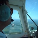
Is that you talking to the girl by the Cessna? I was looking for a photo of you. :cool:
Regards,
Ray
If you get close enough to them you can actually hear what they are saying
-
Thanks Jeff.
HD space - New 6Tb drive on the way for the Af2 project
120gb - how big is that lat/long?
0.50cm = 0 in fset - that means youve got resampling/compression on (not sure if that's the right word, but I change the setting in the .ini so 0 is 0.25cm, a touch sharper but bigger files). Do you think that would work just as well at level 14 geoconvert? Priority is quality, don't care about space or time to build. Also, have you tried changing this setting?I don't fully understand what you're doing with water there, but it sounds impressive! I'll probably wait until aerofly 2 has water til I worry about what to do here.
Ok, so I run tool 1 with a bunch of inf files, get a chance few file and then use that in a second program with the matching bmps, as many as I want. 1 degree lat/long square at 50cm (non resampled) is around 70 bmps, so 2 by 2 squares - a good size - would be 280ish bmps. Sound reasonable?
Your new HD= impressive.
If your priority is quality, you can set the FSET resolution to -1 (0.25m) and use level(14) with the Geoconvert tool.If you have already begun to mess around with FSET, you will notice that the files generated are (BMP files, INF files, Txt files, and Thumbnail files). When you set your resolution, you rubberband the area that you want to make. You will see the squares in the selected area's grid; this is how many BMP files you will end up with in the end. To use the GeoConvert tool and make your scenery for FS2, you will need only the BMP files and the INF files from FSET. The new version of the tool will automatically take the BMP files and INF files and automatically convert them to be used in FS2. Once the tool completes its job, you will take the output files and move them into the Aerofly FS2 folder under your Documents folder.
Depending on the area size you want to cover, will determine how many BMP and INF files are created. In one of my tests I made an area of around 32nm (nautical miles) by 28nm (nautical miles) which was at the following resolution levels (0 (0.50m) in FSET, and Level 14 processing in GeoConvert) and it was around 41 BMP images.
The tool and step-by-step tutorials will be released shortly. Further updates are being made to add even more automation to make it very easy for just about anyone to make their own scenery. So, as I write this further improvements are being made to the tool.
-
Display More
jeff, picture is speck, but i saw it at various places if i remember correctly.
monument valley came with giant trees blocking the entire sky.i found out that my graphic drivers have not been updated for a while, despite my believe they would have.
a reason might be my overaged GTX470 in combination with AMD CPU.Nvidia's experience tool (dowloadable graphics engine diagnose and update tool) seems not even
doing anything for me, since they want to see me shop their latest and most crazy stuff.I am sort of stuck when it comes to hardware, knowing that i should invest 2k for a 2-yeare-relief.
current equipment is (don't laugh):
AMD Athlon 64 X2 Dual Core 5600 + 2...
Gigybyte GA-MA790x-UD3P
NVIDIA GeForce GTX 470
L2 Cache: 128 KB, RAM/Speicher: 4GBsince my other games yet work fine, i was hesitating with the renewal.
aerofly's lean code lets me enjoy at quite high settings, DCS however takes it down.
Not sure yet for myself what connects the driver issue with how my trees fly up the sky.
You need an upgrade my friend
You are really on the low end of the spectrum and very likely causing the tree issues that you are seeing. Get those GPU drivers up to the latest version for that card. This may help, but unfortunately may not as well.Also, you didn't mention your OS but having only 4GB memory if i were to guess, Windows XP or possibly 7 (but that wouldn't leave you much available memory free after the OS eats it up).
Try the drivers and we can move on from there to see if we can get those floating trees grounded.
-
Well, I'd say 'slightly sharper' because things never are 'very sharp' using the Rift.

Well, that opinion is subjective. It's very sharp on 2.00 for me. And a world of difference between 1.00 and 2.00 is confirmed on the Oculus Rift.
-
Thanks for that, Jeff.
I just tried the F-18 down some Swiss valleys and it is superb.
The cockpit truly is Virtually Real - scratches and worn paint!? :cool:
Looking forward to further developments, great job so far.It will only get better from here
-
Nice tutorial.
I'll add it to the Wiki -
If your PC can handle it set the "Render Scale Factor" to 2.00 (or less if you have performance issues). This is a setting under Virtual Reality on the settings menu. This will provide very sharp image in VR mode.
The Oculus Touch controllers are supported in Aerofly FS2 but currently only as preliminary support. This will improve in future updates.
-
Hi Rob,
i'll try to answer some of this for you. The GeoConvert tool can handle just about anything that you can throw at it. Your limitations will be how much virtual memory you have in your computer, and of course the amount of available HD space you have to build your project. I have already converted sceneries that were over 120GB and though it takes a while for the conversion process to complete, it completed just fine with no errors.
In general, i'm getting the best graphical results using the following method: Use BMP files that are 0.50m (0 in FSET), and only go to level 14 in the GeoConvert tool (this will be explained once the tool and tutorials are released). The outcome will be like you see in the images that I posted in the other GeoConvert thread.I don't believe that there are any ways to reverse already converted BGL files and this tool will not support that.
The elevation mesh of Aerofly FS 2 is already there so there is no need to worry about elevation during the conversion. The result of the scenery that you get once the files are converted is outstanding. The trees will populate onto your scenery as well, and it looks really realistic.
I have experimented with some water masks by using a specular layer technique in Gimp and by creating an alpha layer where you can erase the "ugly" water seen in some photoscenery and add in your own, then shine it up using the specular layers. The result is really nice however, it takes some time to carve it all out.
There will be a couple of stand-alone tools once this is released. The one tool will take all of the inf files that are associated with the BMP images and make the tfw files that are needed. You then just run the tool and there you have it, perfect scenery for Aerofly FS2 with very little work.
-
I'm sorry but the aircraft from FS1 will not work in FS2. There were a lot of changes made to the core of the system.
Aerofly FS 2 does have two gliders to fly though.
-
382.33 should be the latest. But this issue was basically seen with AMD GPU's so your issue may be isolated.
Which airport are you seeing this, i'll try to make it happen on my end.
-
How about your GPU drivers. Do you have them at the latest version?
There are only two known items that caused a problem like this, either not on the latest EA version or not having the latest GPU drivers.
There was also a bug with AMD GPU users but that was resolved through an update.
Since you are pretty much the only person with this problem and we can't seem to replicate it, it has to be something on your end.
Also, check the Steam file integrity to make sure nothing got corrupt on you along the way.
-
Very detailed work here. Looks great in VR as well
-
any idea when the tree bug will be solved?
What version are you on?
-
@Trespassers- the elevation model already exists within FS2 but there may be an updated mash that one can use in the future. For now, all you need is the image(s) and the GeoConvert tool to make really nice looking scenery.
-
OK, this all sounds great. so how does the IPACS model library work in with this?
It's not fully confirmed yet but you add a dummy item in either AC3D or 3DS Max, add a coordinate to it and Vref an item from the library and it appears. Quite simple actually.
This could change but it's basically a standard practice. -
Let me further clarify something. Being a government CIO has it's advantages of having access to a host of solicitors and lawyers, and i took the liberty to have the use of FSET vetted to see how it could be used in conjunction with the IPACS GeoConvery tool, and some of what was said is in fact true; you can't use any scenery derived by FSET for profit nor host for advantageous trade (meaning that you can't host data on webservers for the use or potential use of trade for profit). With that said, most aerial imagery of the USA is in fact public accessible and free for download, therefor it is perfectly legal to use this service for creating personal scenery areas for Aerofly FS 2. On the other hand, there are some countries that do provide this data but only for a cost, these are the sceneries that you should be mindful of (those such sceneries are not available in FSET anyway).
Now, for ease of use; FSET makes larger BMP files as well as inf files and smaller thumbnail files. All you need to make scenery for FS2 is those larger BMP files and the inf files that goes with them. The GeoConvert tool does all of the heavy lifting here. You will simply need to run a small program called inf2tfw and this tool makes the tfw file with all of the coordinates needed (from the inf file), you then take the BMP files and those created tfw files and place them into a specific folder inside the GeoConvert tool, define your total scenery area in the TMC file and run it. That's all, you will have the files for your scenery. You can't get much easier than that. It takes around 15 minutes of actual work to make large areas with this tool. Most of the time it takes comes from the time for FSET to make those BMP files and the time it takes for the GeoConvert tool to do its job. There is no piecing together tiles, no trying to align tiles, and no guess work here.
-
For those of you who don't know this yet, there is a new tool that will be in your hands shortly that will allow for you to add your very own scenery to Aerofly FS2. This tool will make it easy for just about anyone to define an area that you want to fly over, obtain hi-res aerial imagery from applications like FSET (FSEarth Tiles), use the easy to use GeoConvert tool that IPACS has worked very hard to make as easy as possible, take the resulted image files and simply drop them into Aerofly FS 2. Want more? How about having access to the IPACS model library? Still want more? How about improved and easier tools to make your own airports, building models, add lighting, and add your airports to the location map. You don't even have to worry about the elevation layer, the conversion results will drop your scenery right over the existing elevation model of FS 2, instant and precise mountains, valleys, and water edges.
Tutorials and easy to understand step by step instructions will be available to you, and of course much support from your friends here on the forums.
Are you excited yet?
Here are some sneak peeks of what can be achieved using this new tool. The results are spectacular: