
Rich, you got my attention now. Fuel and engine management means that you can run out of fuel with engines failing? The default planes all seem to have unlimited fuel if I'm not mistaken. Does fuel weight influence flight characteristics, take off roll and so on? Does mixture act realistically (change of EGT, need to lean at higher altitudes to get the best performance, effect on fuel consumption)? If all those things work that would make the duchess the first serious GA plane for AFS 2, and even more it would prove that realistic simulation can be achieved by AFS 2,which many people still regard as more of a arcade game than a simulator. With features like this I'd definitely buy the Duchess the day it is released and of course also other GA planes from your catalogue (I loved the piper arrow III and Turbo arrow for P3D)
Posts by Fabs79
-
-
I'd also like to see an aircraft with more system depth in Aerofly, at least a realistic cold and dark state with proper stratup and shutdown procedures, fuel system, realistic mixture, realistic landing distances (anyone else here thinking that the default Baron shouldn't come to a complete stop with a ground roll of around 50 meters?). And I was telling myself : if it's just another good looking default plane I won't buy it. But then again, if we don't buy it, no Payware developer will be willing to invest in porting aircraft to AFS 2. And maybe if in a few years AFS 2 has all this system depth, it would be nice to have some developers still around to take advantage of the new technology.
-

I try, to do a tutorial.
 But, what can i say now: It's only made with Photoshop ( CS2 ) and Love!
  In this case its a more complicated and i believe, i needed 10 hours of work for this Tile ( Record! ).
Photoshop shouldn't be a problem, but where can I get this Love you're talking about?
-
Display More
Everybody knows th shameless mess of Google and Bing-images. What i do and what you can do is, bring more harmony in your tiles with a "little" work in Photoshop, like this example:
Before:
after:
It's a "little" handpainting, setup lightning and selektive colorcorrection. Hope, you like it.
My next question: Do i have now the copyright on my own work in this case?
Or, as I sometimes do, i combine google and bing images into one tile.
Could you post your work flow that led to these results? Which program and which tools you used? I tried some image corrections with Photoshop for one of my own sceneries but no matter what I do I just can't get the colors right. It looks better than before but by no means perfect. I played with saturation, color temperature, exchanging colors and so on but nothing really got me where I wanted to go
-
 Display More
Hi,
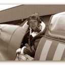
Rich here from Just Flight. I'll do my best to answer any questions you might have about our AeroflyFS 2 projects!Well spotted! The way we approach aircraft development is that we normally go visit an aircraft and we base the instrumentation and texturing on that particular incarnation. Therefore...
[Blocked Image: http://i.postimg.cc/sfL7WQf6/IMG-3689.jpg]
Why the owner(s) had a clock in there and a NAV2 label above it - you got me there I'm afraid.
As long as there is sufficient appetite for our offerings, all of our in-house titles are lined up for conversion to AeroflyFS, similar to how we do for X-Plane these days. Our back catalogue contains a number of other high quality GA aircraft that we're looking forward to getting started on soon, as well as some other stuff I personally can't wait to see in AF2 - Red Arrows Hawk T1A or a Tornado GR1&F3 anyone?
First though, we're working towards having the Duchess ready to go before the end of April.
We'll be releasing some proper specs and a fresh batch of screenshots later today or tomorrow, so check back in with the product page over the next 24hrs for them.
Finally, we're looking for a handful of experienced AeroflyFS 2 users to assist us with some beta testing, beginning right away. Please drop me an email at Rich@justflight.com if you have the time and experience to get involved.
Thanks
Will there be a more complex engine management than in the default AFS 2 aircraft, like realistic mixture, featured in the Duchess? Thanks
-

No reason really, you could technically
I can increase it when I do the next update, but for now on Chrome (and other browsers) you should be able to right-click (or CTRL+SHIFT+C as the map overrides the right click) and hit inspect on the slider and change the number from 2500 to anything you want (I've attached a screenshot showing this). That number will persist until you reload the page.
We can place custom objects, but the biggest issue as far as I recall is knowing their dimensions. I can easily allow you to place a "custom object marker" somewhere and you will have to specify its object name (so it uses the correct one), but that's about it. We can't infer its dimensions since these files can't be read. The way xref would work is because I'd know their dimensions in advance and they'd be pulled in from some mapping (similarly an object can work if you provide its exact dimensions). I think you also have the potential issue of different rotation on an object, I haven't really looked too much into it as I've swapped jobs mid Feb and have been generally more busy with the first few weeks.
I'll make an effort to get this up on a github repo next weekend, it's plain javascript "hacked" together with a few libraries anyhow, people should be able to contribute if they wish to! Most of the remaining work with xref has already been done in some form in the current editor.
Nabeel, a custom object marker would be completely sufficient. You wouldn't need to know the exact dimensions because it would be the job of the guy who creates the custom model to get the dimensions right. Let's say I'm modeling the church in my home town in Blender: I can get the dimensions of the church with the measuring tools in Google Earth, switch Blender to a metric scale and then model the church exactly to scale. In blender I can place the origin of an object anywhere within the model, so for example I'd place it to the front door of the church in blender and then I'd place the custom object marker in your editor to where the front door would be on the satellite image. That should work, shouldn't it? Considering the orientation of the object, the xref objects also have a origin point and the x, y, and z axis pointing to specific directions. That way an object can be oriented correctly by specifying at which angle for example the x axis should be rotated, correct? The exact same thing can be done in blender and I guess in all the other 3D programs as well. The x, y, and z axis go from the origin that you set for your model and that way the orientation could be defined for a custom object just like for an xref object. If all that is possible it would be a huge step forward to customizing our sceneries.
Cheers, Fabian
-
Ich denke im Moment ist Aerofly einfach noch nicht in einem Entwicklungszustand der komplexe Anflüge mit SIDs, STARs etc. erlaubt, ich nutze es nur zum General Aviation und Hubschrauber fliegen. ILS funktioniert in den USA auf den wenigen Flughäfen die ich getestet habe eigentlich ganz gut. Ich nehme an dass die Aerofly Database Navigationsdaten nur für ihre eigene Standard Szenerie, also westliche USA enthält und der Rest der Welt schlichtweg keine oder nur unvollständige Daten hat. Vermutlich hat IPACS als sie die Datenbank gemacht haben auch nicht damit gerechnet dass externe Entwickler in andern Ländern der Welt Szenerien anbieten. Ich persönlich nutze Aerofly nur wegen der gigantisch guten Performance in VR und der guten Grafik, außerdem gefällt mir die Flugphysik. Aber wer wirklich Airliner nach originalprozeduren fliegen will ist bei AFS 2 glaub ich falsch. Da fehlt noch vieles mehr, wie ATC, AI, Wetter etc. Da braucht man dann halt doch P3D oder Xplane.
-
Nabeel, do you think it would be possible to place a custom object with your scenery editor? That is if we have a tmb file for that object that we could select it to be placed in a location instead of a cultivation building? At the moment I need to use model converter X to assign a geolocation to an object which is a little annoying if you have to place multiple instances of a certain model.
Thanks, Fabian
-
Can't wait for this scenery!
-
-
I don't know about Aerofly but what you describe can be seen in the FSX based Simulators as well, reason being exactly what you guessed - buildings being positioned on a low res mesh before the higher res mesh loads in. I guess the only workaround would be to change the distance at which the high red meshes is loaded, which would probably decrease performance significantly. I think there's a reason why most simulators ship with an average resolution mesh by default, you have to make a compromise between visual quality, performance and susceptibility to artifacts and visual errors.
-
I don't really understand, are all those new aircraft available as of now or are you planning to make them publicly available in the future? I haven't seen a download link yet.
-

Thank you so much! Fabs79
De nada
-
 Display More
Only just realised that USGS expose their orthophoto catalog as tiles. I was previously trying to automate the download of whole large images.
https://basemap.nationalmap.gov/ArcGIS/rest/se…yOnly/MapServer
OK, version 1.1 will be all about additional orthophoto sources
Arcgis
USGS
kartor.eniro.se (Norway)
Hi Nick, fantastic work. USGS as a source for orthophotos would be great because it would allow people to share their scenery without copyright infringements like with Google or Bing imagery.
Could I ask you to have a look at this site if you have the time?
http://www.geoportal.rlp.de/mapbender/plug…layerid%3D61676
These are high quality, open source 0.4 m / pixel orthophotos for the federal state of Rhineland-Palatinate ( where I live in Germany) provided by the government. Do you think Aeroscenery could somehow download, stitch and geoconvert these files, too?
Thanks and cheers, Fabian
-
Hello! Aerofly fs2 is spectacular, I am from the Dominican Republic and I would like to make it better for aerofly fs2, as it is called the tool that uses nickhod, to start experimenting! I would appreciate it..
Hello! friends, it is a pleasure to be in this forum for the first time, Aerofly fs2 is spectacular, I am from the Dominican Republic and I would like to do it for scenery for aerofly fs2, as it is called the tool that nickhod uses, to start experimenting! I would appreciate it
The tool is called aeroscenery and you can download it from github.com here.
https://github.com/nickhod/aerosc…/tag/1.0.0-beta
You have to download the msi file and install it. There's also a pdf tutorial somewhere on this forum, you'll need to search for aeroscenery tutorial and you'll find it.
-
Hello HerveF,
Thank you for your kind words and helpful tips!
I have informed myself in advance and downloaded free airplanes and various paintings ...
Purchase software is coming gradually. The first Scenery will of course be the Switzerland ... I have to have as an old Swiss from pure sense of duty already ...;-)
If you plan on buying the Switzerland DLC don't forget to also download drassaud's excellent freeware cultivation for Switzerland or the OrbX Freeware. It takes the scenery to a whole new level.
-
Some technical questions, just to the see if I'm understanding things correctly:
The tsc file is telling Aerofly where the center of the cultivation area is, and the size of the area where cultivation should be placed. The toc file tells Aerofly where to place each separate object within the area specified by the tsc file. Is that correct? But what's a tmb file for? And how does aerofly know in which library it needs to look for the objects? The toc file only says xref, not xref_usa or something like that. And do I need to Copy all of the xref library into my addons\scenery\places folder or can they stay where they are?
-
-
I saw that link before but judging from the thumbnails shown there I was under the impression that the library only contains aircraft?
-
Hi,
I'd like to ask if and how I can access and place objects that are part of of the Aerofly default scenery in my own sceneries? For example, the fantastic Monument Valley has 3D models for cars and buses parked at a viewpoint. I'd like to do something similar for my own scenery. Can I somehow use these objects or do I have to have to create my own?