How to create tsc-airport definition files from FSX/P3D BGL Files.
(You need to have .NET Framework 4.6.2 installed.)
1. Use Bgl2Xml from scruffyduckscenery. Select in the GUI the ap...bgl files from the FSX/P3D installation folder.
2. Write the decompiled Xml File somewhere suitable, for example: D:\AeroflySDK\BGL2XML\XML. There should be files like APX00210.bgl.xml
3. start the program xml2Aerofly.exe.
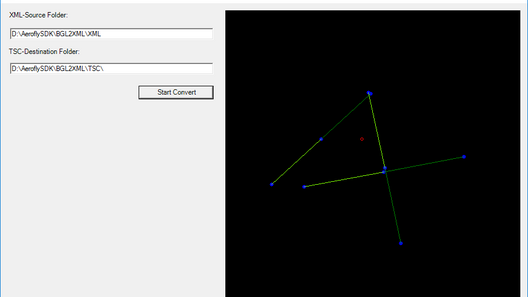
4. Write the D:\AeroflySDK\BGL2XML\XML into the first box.
5. Create a destination folder somewhere suitable.
6. Write the path (for example: D:\AeroflySDK\BGL2XML\TSC\) into the second box.
7. Don't forget the final '\', the program will throw an error, if not.
8. Click on Start Convert and see the converted airports in the GUI.
9. look into the destination folder to find the tsc files. There will be sub folders with the country and inside a subfolder with the first two letter of the ICAO code of the airports. This will create the program.
10. Copy this files into your Aerofly FS2 Addon folder: C:\Users\(Your login name)\Documents\Aerofly FS 2\scenery\places
Next time you start Aerofly FS2 you see the airports in the airport selection menu. Of cause, you will have no objects inside the sim, you cannot see any runway or buildings nor textures. This is only for a starting point create your own scenery.
This Program ist provided without any warranties.
(c)2018 flightXtreme
xml2tsc.zip