
Resolved - No clue. Reinstalled the whole thing an now it is OK
No update 😉
Resolved - No clue. Reinstalled the whole thing an now it is OK
No update 😉
Looks like we got an issue with the shaders. At LSZG I get no ground for some reason. No clue. The runway and apron is there, but the surroundings end up in a big hole.

Is that gap between your scenery and the default being caused by a mask that was created when you converted your scenery? If so, you might not be seeing the default scenery at its max resolution, making it look worse than it really is.
No, the default scenery does look like this.
Texture Pack Southwest USA is installed
I showing you the difference between my aeroscenery google and the default with the highres pack installed
For me a quite significant difference
I haven't found an A300, where did you get it?
Hi
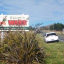
Yesterday I too a ride from Mariposa into the Yosemite Valley. While comparing it to Grand Canyon and Horseshoe Bend, I mus say I am disappointed by the sharpnes and quality of the Yosemite area. Did I miss something or is the resolution really mediocre in that area?
I am thinking of doing Binter. They used to have ATR, but as there is no ATR, I think the Dash is a good replacement. Besides this, SkyWork did not have the Dash already long before the grounding last year.
My biggest issue, time. I simply don‘t have the time too do all I‘ld like to
and Aerosoft release?
I am trying to find my Arrow III for AFS2 on my account - unavailable. Can one send me the link to the product order page? ![]()

Great but Is it possible to have this without this hideous new Garmin ? , give us an old radio please !!
No. My c152 was recently equipped with a 430. 😉
I got all Justflight ones an two platforms. I am ready for the third. My plane liveries if those i fly in real life are already done for XP and P3D. Piece of cake for AFS2 if there is a painkit.

I am probably going to enjoy all the upgrades to the Learjet 45, but I sure am going to miss flying the R-22. I crash and burn within 10 seconds on every time. duh. Just rolls over and dives into the ground. I can't stop it. Flight controls are calibrated. It started with the update today. Sure wish there was a way to opt out of the update.
Ray
I took the R22 for a ride from GCXO to GCTS. No issue. Flies as shitty as the real one. You will not get an AS350 through the upgrade. I is still an R22. On of the worst choices you can ever make for the ppl. Sorry for being honest.
I would have thought it was up to VATSIM to adapt to AFS2, rather than the IPACS Team changing their excellent product to accommodate VATSIM
Yes and no. Yes for adjusting the client. No, because IPACS first needs to provide an interface, which does not exist in the sim.
International Virtual Aviation Organization (IVAO).
I remember when it was the accepted thing to actually put the acronym then the full name in brackets. These days the idiots seem to think we can always guess what an acronym stands for.
Who are you calling "idiot"?
Right after IVAO ![]()
There are two things i noticed from my conversions, but these observations are not final. In FSX sceneries have mixed DDS DTX5 textures with alpha and BMP DXT1 texture with alpha. The fact of seeing BMP, does not mean it is a BMP without compression. These textures convert very bad. I convert these to DDS before any processing.
Another issue i the too much shining. I tend to remove the alpha channel which leaves the surface appear less shiny. Not ideal but help.
Ground texture tend tu flicker and not show up entirely. I have an explanation why they don‘t show up entirely. Actually the ground is not flat, this leads to the textures go underneath the surface. What is the reason for the flickering I haven‘t found out. I usually convert only the lines of the airport.
Lights don‘t convert. They show in black squares or triangles. Haven‘t managed to convert lights.. The airports will not have lightning at night.
one last thing i forgot. Make sure that all standard fs textures are in the scenery folder before conversion. I found that transparent roof and walls relate to the missing default textures. I copied these into the scenery texture folder, then it was OK.

First one is of course
ArcGIS http://www.arcgis.com/home/webmap/viewer.html?useExisting=1
MartinM posted some others, but I can't find the post now.
here we go AeroScenery Releases - Easily Create Photoreal Scenery
Specially the swiss admin.ch i‘ld love to see
https://map.geo.admin.ch/?lang=de&topic…877121931235939
#################################################### # Swiss Federal Geo Portal # Restrictive copyright + water marked # (see http://www.swisstopo.admin.ch/internet/swisstopo/en/home/swisstopo/legal_bases/use_without_licence.html #################################################### elif website=="CH": server=random.randint(0,4) url="http://wmts1"+str(server)+".geo.admin.ch/"+\ "1.0.0/ch.swisstopo.swissimage/default/20151231/3857/"+\ str(zoomlevel)+"/"+str(til_x)+"/"+str(til_y)+".jpeg" fake_headers={\ 'User-Agent': user_agent_generic,\ 'Accept':'image/png,image/*;q=0.8,*/*;q=0.5',\ 'Accept-Language ':'en-US,en;q=0.5',\ 'Accept-Encoding':'gzip,deflate',\ 'Referer':'http://map.geo.admin.ch',\ 'Origin':'http://map.geo.admin.ch',\ 'Connection':'keep-alive '\Is it legit to use the swiss geo data? yes, for private individual use
welcome back, Nick
Well, if you want to pass me over some PSD files, i'll create some liveries for you ![]()
Let me guess - we cannot ask the dev of O4XP to create O4FS2