
Currently on the road with the family. Will give the Swiss Geo Portal a try after August 4.
Thank you already now!
Currently on the road with the family. Will give the Swiss Geo Portal a try after August 4.
Thank you already now!

Are you sure you checked the professional mode checkbox?
Maybe, because the checkbox is not very obvious - it is a white square in my case, when active.
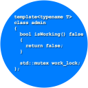
How do you flatten terrain in Aerofly? In FSX it was very easy, you could use SBuilder X to draw a Flatten polygon around the area that you'd need and assign a height to that polygon. The mesh in within the polygon was replaced by the fixed height you set, so you had a complete flat area to work with. IIRC you could even setup sloped polygons. I'd love to have a tool like that for Aerofly.
As per my understanding, there is no such easy way to do, like with XP or FSX. The only way appear to me to use the 3D Tools like 3DMax or AC3D
GCTS and GCXO should be worked on creating the ground correctly. Taxiways have bumps. I tried with a conversion. would work nice, if the ground would be OK.
Line 5 should be the closing bracket ![]()
19m elevation vs default 150m, what an improvement. Even if the orthophoto Ray used are lower than my ZL19 which I have currently, the elevation is very cool!
Already got it!
The elevation mesh is ways better than the default. The Teide and Los Gigantes looks so much more realistic!
If one could convince MK.Studios to do the airports, that would be awesome
 Display More
Hey all,
It's been a while!
I'm looking at getting back in and finishing development for the Spitfire. I was just wondering if there are many changes I should be aware of (I was reading up on a new engine system?).
Hopefully this bird will be flying the Aerofly skies very soon!
Cheers,
Alex
If the Spitfire will be as great as the X-Plane variant, this will be an excitement
I know one that can ...
But, honestly, your cultivation and your photo scenery does look much better with a 10m mesh
By default Aerofly FS uses 10m mesh accuracy for regions where we added airports. So this basically means all of the West Coast in the USA features 10m. The other parts of the world usually only have a lower resolution to reduce the overall size on disc. Aerofly FS would in theory support 2.5m mesh accuracy, but elevation date is hardly accurate enough to justify using it.
The dolomites regions is likely not a 10m mesh. Neither it was in the Canary island. I got a 10m mesh for Tenerife done. The coastline and the Teide are clearly different.
Do you need the POH of a C152?

Hello,
Do the paint shop pro files not open in photoshop?
no

I did not find the information of the pitch on everyone AFS2. I read that it is very accurate ..
'Very accurate' does not mean anything if the height is not indicated.
long ago .. Fsx default was 76m and 9m in some area and paid addons allowed to have 1m.
So Aerofly is covered with a mesh at what height precisely.
I don't think that the mesh is accurate. At least not outside of the scenery areas. Go to "Drei Zinnen" Tirol. You will find some really ugly mountains. Far far off reality. It is comparable to the mesh provided in XP9.
I need a PSD layered template, please
Orbx cultivation actually has houses and objects in LSZG overlapping with the default scenery. You cannot edit these with cultivation editor. Thats an issue for all my self converted airports. It has less floating houses however. The swiss cultivation on org is nice, can be edited to some extend, not the forrest unfortunately, but has floating houses. lot of them.
yeah. And one more thing that is strange. In the coast of the normandy, you will ahve trees and bushes in the water
HiFlyer: We just updated the Steam version. Could you please try the R22 again with either Xbox controller or VR controllers in Easy Mode. Is it controllable now?
dvd updated too?
Hi
Is there a way to adjust the scale of an object when converting from FSX to AFS2?