
The "2" jets got me to Zurich and Honolulu earlier and the navaids and very basic flat scenery worked well so why not try Honolulu to Tokyo and on to Zurich to complete the round the world by Aerofly 2?
I used a rhumb line again to simplify navigation and tried a single average magnetic variation for the Tokyo-Zurich leg. This would allow a single heading to cover the whole long leg so that the sim could just run in the background.
The local variation ran from 7 west slowly down to zero and then up to 7 east and then back down to 4 east which would make the plane on a single compass heading fly a little anti-clockwise, straighten out, fly a little clockwise and then back a bit. The track would curve to the south and would resemble a shallow "?" fallen to the right. If the variation had started and ended the other way round the track would have curved northwards and would have been closer to a great circle and therefore would have been significantly shorter.
Passing about 5 miles north of Midway. 1/4 degree north of track.
The 1,150 nautical miles from Honolulu to Midway island went fine. Pearl and Hermes atoll and Kure atoll were in line close to Midway.
Uraga channel leading into Tokyo bay
Landfall was at Hachijojima island, 146 miles south of Haneda airport, 3.9 degrees south of track after 2,251 nm. I think that is about 2 degrees of possible anticlockwise bias in the sim and about 2 degrees of average variation estimation error from me. The error on the Atlantic crossing was 2 degrees north (or anticlockwise).
ILS alive on finals landing at Tokyo Haneda. An NDB on 9 nm finals was active.
With the big nav error I compared a variation map based estimate of the Tokyo to Zurich average variation with a calculated average taken from transferring the rhumb line into SkyVector with about 400 nm intervals. The local variations times the leg lengths was added up and divided by the total length. My estimate was 2.44 east, the calculation was 1.2 east which I used. The track would dip south of the rhumb line so the variation is only approximate.
Climbing past Nagoya on a heading of 275 magnetic.
Approaching the south coast of Korea.
Longnan in China.
Wulanwula and Xijir Ulan Hu lakes. Leaving Qinghai, China flying into Tibet.
Karakorum mountains, Pakistan on the left, Xinjiang, China on the right. K2 is just above the vertical stabiliser.
Sholgara, Afghanistan on the nose, Balk (Bactra) above the stbd wingtip.
Okarem, Turkmenistan, on the east coast of the Caspian sea. I added a degree here as my overall magnetic heading should have been 275.3 degrees. A degree at 2/3 the way would make up this.
Neftchala, Azerbijan with Baku far right, on the Caspian sea west coast.
Van lake, Turkey. At this point the track was about 350 nm south of the rhumb line and allowing for reducing magnetic variation was pointing at somewhere like Naples so a course correction was needed. There was about 1,600 nm to go so a mental sum gave 1/4.5 or .225. .5 is 30 degrees, .1 is 6 degrees so .225 is 13.5 degrees. At the constant heading the track would go a bit to the left as the east variation reduced so a couple of extra degrees would help so 15.5 degrees was added to give 275 plus 15.5 equals 290.5 to steer.
Over the Black Sea approaching Varna, Bulgaria.
Drobeta-Turnu Severin, on the river danube, Romania. After this I reduced the headings as I remembered that the track should have been well south of the rhumb line and because of this I had over corrected. At lake Van the error was probably only about 200 miles in 4,800 travelled, 2/48, 2.5/60. I think the 2.5 degrees could be close to a possible sim anticlockwise bias.
Edit-2 degree rhumb line more anticlockwise (presumed sim bias, equivalent to a compass needing a swing) passes through Tbilisi, distance to the flown track north of lake Van is 150 nm. 150/4800, 50/1600' 100/3200, 1/32, <2/60. ie less than 2 degrees. This might be not be all that much more than the magnetic variation induced dip in the track.
Belgrade, and Vrsac, Serbia.
Maribor, Slovenia.
Berchtesgaden Alps, Salzach river valley turning north to Salzburg. Austria and Germany.
Zell am See on the nose. Austria
RTT (NDB) location and Innsbruck. Austria.
Lake Constance/Bodensee appearing, turning for south lake Zurich for Rwy 34 ILS. Switzerland, Austria and Germany.
About to turn long finals Zurich.
A bit flatter than in "FS".
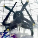
ILS Zurich runway 34. Aerofly 2 flown around the world.
The ILS seems to be about 800 feet above the surface in the false elevation basic scenery.
All the ILS pics needed an outbound pass inside 3 miles to wake-up the Aerofly ILS.