
The grid in your Screenshot shows the area I'm speaking of. It's sad that there is no other way around this than deleting all vegetation in such a huge area just to get rid of maybe three or four intruding trees. To be honest I'm a little frustrated, I spend some hours modeling an though the result is far from perfect I think it's a decent model for a beginner. Now I can't really use it in the simulator without massive negative impact on the rest of the scenery. In FSX and P3D you could draw an exclude polygon in SBuilder X within seconds and by that clear the area of any other vegetation or building that might get in the way of your own buildings. I guess in the future I'll only create content for areas that don't have any default scenery to begin with to avoid conflicts like this.
Posts by Fabs79
-
-
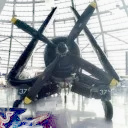
Hi,
I created a model and placed it at the proper Location within the Default scenery of Aerofly in San Francisco. Unfortunately there are trees where there shouldn´t be any, and those trees stick out of my model. Is there any way to get rid of those trees in the Default scenery?
Thanks,
Fabian
-
Ok 800 already seems like an awesome amount of cars, I guess my years with FSX and P3D has made me modest, the sheer presence of some 3D cars on a parking deck was something that could bring FSX to its knees, I never would have expected that someone would ever exceed 800 cars on one spot of a scenery.
-
Maybe Rodeo's low poly car pack could be useful? Those objects should be placable at a predefined height, with autoheight set to false and then the height value in meters?
-
I'd love anything that could realistically fly around the Lukla area
-

for day, insert month

What we need is a blender exporter. Blender is free and as good as the expensive programs
Over to developers on this one
I export blender models to collada files and load them into model converter x, than save them in Aerofly object format
Works for buildings, I see no reason why it shouldn't work for aircraft...
-
Well, I'm currently on holiday in Fuerteventura, so I think this will be a must have when I return. Thanks for the work to all those involved.
I'll be flying to Lanzarote on Sunday, so we can wave to each other from the coastlines
-
To be fair the cloud behavior in VR is exactly the same in P3D and I'd reckon Xplane 11 probably Is not better in that regard. As Jeff stated as long as 2D images are used to depict clouds you'll always have those rotating clouds trying to keep a direct view axis to your face. It's even more obvious in Simulators that have cloud shadows where the shadow on the ground also rotates wildly while you look around. I guess the only solution would be true volumetric clouds like I saw on some tech demos for the Unity engine on YouTube. But I could imagine that this would be a huge performance killer.
-

well for those who like flatten I have bad news because on the next update the mesh resolution will double; this will add more bumps; but of course airports will sit on flatten
aerofly fs2 work well with high res mesh; now we are going to carve further into the Canary islands terrains; those crucial features characteristic of those islands; walking tracks; roads; and cultivated terraces; bring them out as much as possible
Sounds interesting, I guess I'll have to check this out. Now if someone could create high quality Airports for the Canary Islands that would be great.
-
simple test , real R22 and previous flight model, when you lift off in the real R22 and the previous flight model you need to apply a little bit of left pedal in anticipation of the rotor torque that will catch you when you pull collective , once you apply left pedal and catch the spin you need to stabelize all other movement with the pedals and cyclic before gently raising the collective to lift off into the air. this model requires almost zero left pedal and zero stabelization, you can just pop in to the air without hardly any correction. the previous model was spot on in this regard.
how real pilots are saying that it is more accurate now is beyond me!
There must be something seriously wrong with your setup, the new flight model still needs massive left pedal input to counter the torque induced yaw during takeoff and still a whole lot of cyclic corrections to counter the roll tendencies, it just doesn't bounce from full left to full right within a fraction of a second or by moving the pedals or cyclic by the a millimeter anymore like it did before. Are you sure you checked the professional mode checkbox?
-
Could you post an image of the coverage area? Does it connect with the Southern Florida DLC or is there a "Blank" space in between?
-

Perhaps I'm mixing canaries and rutabagas, but how did the Lukla scenery handle these sorts of elevation issues?
If I'm not mistaken Sascha said that he created a custom mesh for the complex Lukla airport terrain. There's a picture of it somewhere in the Lukla development thread
-
As per my understanding, there is no such easy way to do, like with XP or FSX. The only way appear to me to use the 3D Tools like 3DMax or AC3D
Another possible solution could be to create an geotiff with QGIS or ArcGIS from a 3D elevation data source where each Grey scale value is assigned to a certain height. Theoretically it should be possible to manually edit this tiff file with Photoshop or GIMP or whatever and then draw a polygon around an area with exactly the grayscale value that equals to the height you'd like to set, but I guess this would mean an awful lot of guesswork and trial and error.
-
How do you flatten terrain in Aerofly? In FSX it was very easy, you could use SBuilder X to draw a Flatten polygon around the area that you'd need and assign a height to that polygon. The mesh in within the polygon was replaced by the fixed height you set, so you had a complete flat area to work with. IIRC you could even setup sloped polygons. I'd love to have a tool like that for Aerofly.
-
I'd guess it's an extension of the southern Florida coverage area up to cape canaveral, which would be a nice idea in the year of the 50th anniversary of the Apollo 11 mission.
-
 Display More
I have uploaded a new version:
-Improved flight dynamics
-Added animated sun blockers
-Pulling the carburetor lever now causes a slight rpm drop
Please remove the old version before installing.
Thank you so much, Sylvain.
-

It all depends on what blows your skirt up. Us Floridians think of Switzerland as a place for expensive vacations, and New York City as a place for changing planes.


Of course someone who actually lives in the area will get his enjoyment out of the scenery, and I'm not saying it's bad, actually it is very detailed and well made. But I still believe some regions of the world will appeal to more people than others, and for flying I personally find mountainous terrain more interesting and varied.
-
NorthEastern USA/New York is also amazingly discounted and is to me TEN times more interesting than Florida, I very rarely use Florida, it is flat and monotonous, New York is crammed full of good stuff. It will cost you the price of a big bar of chocolate, hint ..... go for it!
I feel the same about Florida, it's not the developers fault I guess, it's just that a completely flat landscape always falls short compared to breathtaking mountain sceneries like Switzerland or Lukla or the iconic New York area. It's a similar problem with ORBX Netherlands. I'd also wish for a more interesting region as the next IPACS DLC., and I'd even rather pay for a increased detail default area (like complete cultivation and landmarks for the western US) than a Central Arkansas DLC or something like that.
-
Thank you for that great freeware, Sylvain! You're one of the few developers who supported Aerofly from very early on and I hope we'll see more from you in the future.
-
No, the default scenery does look like this.
I can confirm the default scenery looks bad in yosemite. I'm guessing it's the usual 1m per pixel free USGS imagery used everywhere else in the default Aerofly. In yosemite it may be aggravated by the steep slopes of the mountains which are makes the pixels get stretched vertically even more. Your scenery is ZL 17 which means 0.5 m per pixel if I'm not mistaken. That means four times better resolution which of course will look better.