
 English
 Deutsch
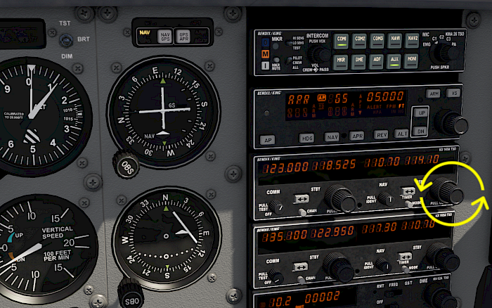
Enter Standby Frequency
Turn the small and large frequency knobs on the NAV1 radio receiver to select the ILS frequency.
For the Monterey ILS 10R enter 110.7.
You probably have seen aircraft takeoff and land even in very poor visibility and wondered, how do you find a runway if you can’t see it?
Before the widespread use of GPS aircraft relied on ground radio stations and on board receivers to calculate their position relative to them. And because the accuracy can be quite good they are still in use today. One of these systems is the instrument landing system (ILS), which we’ll describe below. With Aerofly FS you can of course also practice these ILS approaches.
Some runways are equipped with an instrument landing system (ILS) that emits electromagnetic signals that can be received with on board devices radio navigation receivers. The signal for the ILS approach has two components:
The selection of the ILS station is achieved by tuning the correct ILS frequency and setting the approach course. The aircraft is flown towards the signal from the runway and the pilots follow the beam down to the runway. Some aircraft like the Airbus A320 or Boeing 747 can even fly the ILS down to touchdown on autopilot.
For this tutorial we are going to fly the Cessna 172 and use the ILS RWY 10R at Monterey Regional airport in California, located about 100 NM south of San Francisco. The frequency for this ILS is 110.7 MHz and the approach course is 098°.
Turn the small and large frequency knobs on the NAV1 radio receiver to select the ILS frequency.
For the Monterey ILS 10R enter 110.7.
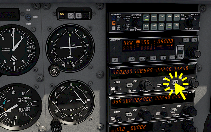
Press the <-> arrow button on the NAV1 device to swap the active and standby frequencies. This activates our entered frequency and the receiver is now tuned to the station. When you are within range the needles in the cockpit should pick up the signal.
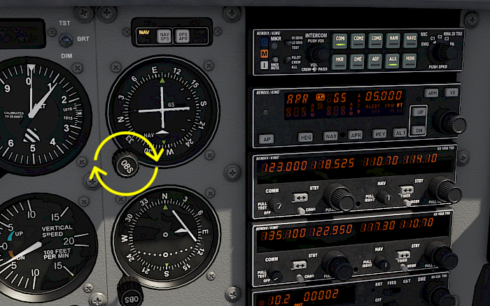
Rotate the NAV1 course knob to set the approach course for the ILS.
In our Monterey example set a course of 098°.
With the NAV1 receiver tuned to the correct frequency and the selected course set to the approach course we will see a needle deflection on the NAV1 course deviation indicator (CDI).
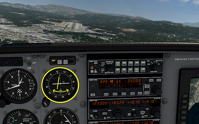
The vertical needle can move left and right and shows us if we are centered on the localizer or not.
When no signal is received by the device you will see an off flag. Check the active frequency and check that you are close enough to the station (less than roughly 20 NM)
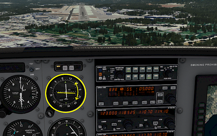
The second needle can move up and down and indicates our deviation from the desired glide path. Most of the times the glide path is at a 3° angle to the horizon.
Not all localizers have a glide slope, in that case the needle won’t move and an off-flag is shown.
Managing these approaches takes a lot practice and even if you are already qualified to fly in instrument meteorological flight conditions (IMC) you have to do stay proficient to fly through the fog and clouds safely.
In Aerofly FS you get the chance to fly these approaches with a global navigation database coverage with quite a lot of our default aircraft. Practicing with the slow Cessna 172 or Beechcraft Baron B58 is one thing and watching the autopilot land fully automatically in the A320 or B747 makes it seem easy but manually flying in the dark with zero visibility in the old 737 is quite a challenge and a lot of fun.
And even if you don’t make it you can just go to the location dialog and reset your position to the beginning of the approach in an instant.