
I've uploaded a new version of AFS2 Grid Generator:
v1.3 changelog:
- Add support of vegetation files "mapt_*.ttc"
- Add Geoconvert boundaries coordinates into general grid information
In order to help creation of .tmc file, for each square you will have [Lonlat_min] & [Lonlat_max] informations (to avoid creation of no desired tiles at borders: min value are rounded to 2 digits upper value and max value are rounded to 2 digits lower values)

Thanks. Hmmm...interesting. Did you scan the whole folder vegetation? This is the only one with tree information. I cannot scan the whole folder as your tool does not scan mapt files. I copied the files that cover Switzerland into an own folder, deleted the t from the file name (mapt --> map) and made a scan. As I said there are no trees missing in the switzerland scenery, hence the files are complete. Can you please tell me what file names you have where my files in the kmz are missing.
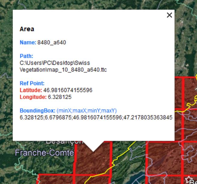
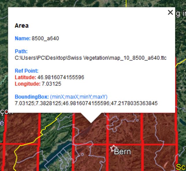
As you can see I have 8480_a640 and 8500_a640. What is in between?
between your two tiles in your screenshots:
84c0_a640
Steam Games\steamapps\common\Aerofly FS 2 Flight Simulator\scenery\vegetation\mapt_10_84c0_a640.ttc